Flood risk in the tropics is changing and, in many regions, intensifying. Understanding the weather systems behind it is essential for building resilience. In this article, JBA Climate Scientist Jack Giddings explores the science of convection, monsoons and tropical cyclones, and how they interact to shape extreme weather events across the tropics.
Ready to discuss your next project? Contact our team today.
Flooding is one of the most damaging and widespread climate hazards affecting tropical regions. Each year, intense rainfall and storm surges displace millions, disrupt economies, and undermine development progress. The root of this risk lies in the tropics’ unique weather systems – driven by heat, moisture, and complex interactions between the ocean and atmosphere.
Understanding how these tropical weather systems form, evolve and interact is essential for anticipating flood events, designing early warning systems, and building long-term resilience. This article explains the science behind tropical flooding – revealing how seemingly separate systems like thunderstorms, monsoons and cyclones are, in fact, part of a connected climate engine.
Tropical weather begins with energy. The region between the Tropic of Cancer and Tropic of Capricorn receives more solar radiation than any other part of the planet. This intense heat warms ocean surfaces, triggering evaporation. The rising of this warm, moist air – known as convection – drives cloud formation and precipitation.
In the tropics, convection is a dominant feature. It is the foundation of thunderstorms, rainfall patterns, and the formation of larger weather systems. While some convective activity remains local and short-lived, under the right conditions it can develop into powerful, long-lasting events that impact entire regions.
These conditions – abundant moisture, atmospheric instability, and favourable wind patterns – allow convection to become organised. This marks a shift in spatial and temporal scales, transforming isolated storm cells into sustained, structured systems capable of producing extreme rainfall and flooding.
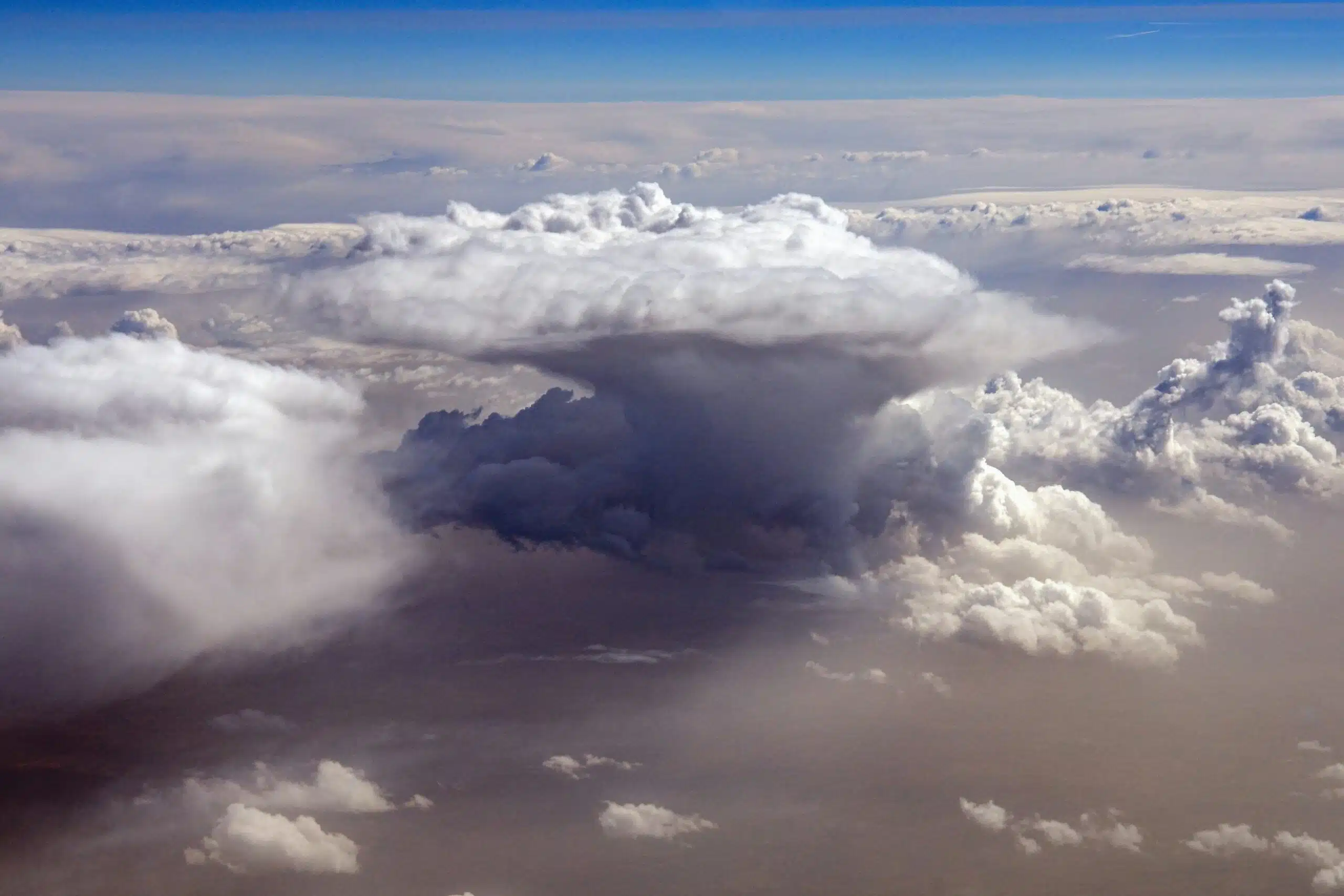
Convection in action, forming isolated thunderstorms.
Organised convective systems are responsible for much of the intense and prolonged rainfall seen in the tropics and they are central to many of the region’s most dangerous flood events. Common types include:
These systems are sustained by factors like:
When these systems stall or repeatedly track over the same area, they can deliver devastating amounts of rain – causing flash flooding, river overflow, and landslides.
These organised convective systems do not occur at random. Their timing, location and movement are strongly influenced by the Intertropical Convergence Zone (ITCZ) – a dynamic belt of rising air and subsequent storm activity that circles the Earth near the Equator. It forms where trade winds from the northern and southern hemispheres meet, forcing air upwards and fueling near-continuous storm formation.
The ITCZ is not fixed, it shifts with the seasons, moving north in boreal summer and south in austral summer. This movement drives seasonal rainfall patterns across the tropics.
In regions where the ITCZ interacts with large landmasses, its influence intensifies, drawing in more warm, moist ocean air driven by strong inland heating that sets the stage for monsoons. For example, the seasonal migration of the ITCZ over the Indian subcontinent and over West Africa initiates the monsoon, driving intense storms. These powerful seasonal systems are, in effect, the regional expression of ITCZ-driven convection, magnified by land-sea temperature contrasts.
Monsoons are large-scale, seasonally reversing wind systems that bring distinct wet and dry periods to tropical and subtropical regions. They occur when land heats more quickly than the surrounding ocean, creating low pressure that draws in moist air. As this air rises over land, it cools and condenses, producing widespread and often intense rainfall.
The South and Southeast Asian monsoon is the most well-known. It delivers up to 80% of India’s annual rainfall and is vital for agriculture and water supply across the region. But it also brings substantial flood risk, particularly in low-lying deltas like Bangladesh where saturated soils and poor drainage compound the hazard.
Monsoons are not limited to South Asia (Figure 1). Across the tropics, they play a central role in shaping seasonal weather and flood patterns. While their timing and intensity vary, they all depend on similar drivers: the seasonal migration of the ITCZ, regional land–sea temperature contrasts, and the availability of moisture.
These monsoons drive flood risk across a wide range of geographies – from the Sahel to the Amazon basin, and from the Gulf of Mexico to the Mekong Delta. Their variability is influenced by larger-scale climate systems, such as the El Niño–Southern Oscillation (ENSO). For example, ENSO can alter both the timing and intensity of rainfall during the South and Southeast Asian Monsoon:
Understanding these patterns is essential for seasonal flood preparedness, water resource planning, and early warning system design – especially in regions with high exposure and limited infrastructure.
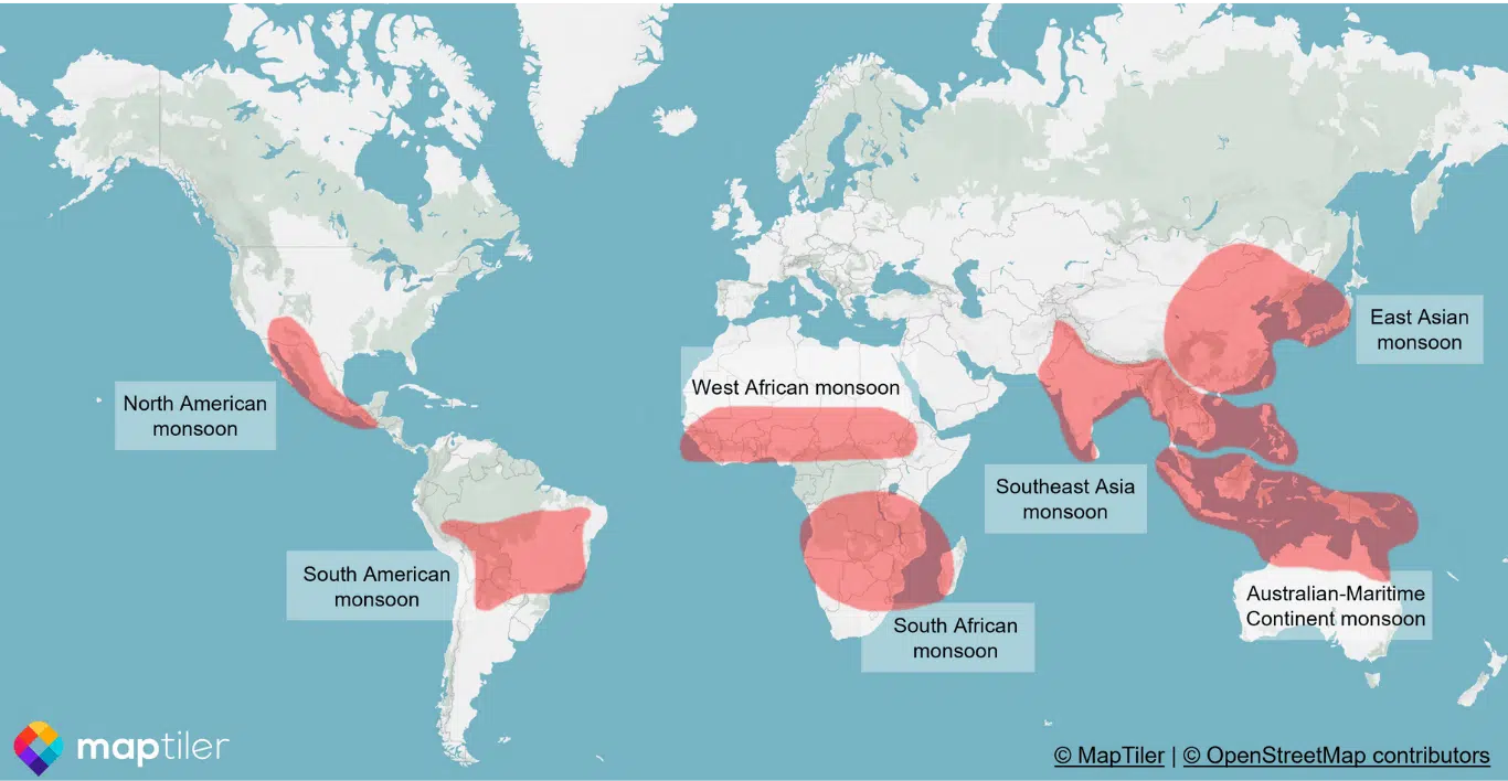
Figure 1: Monsoon regions around the globe. (Figure adapted from Figure AV.1 from IPCC, 2021).
At the extreme end of organised convection are tropical cyclones – intense, rotating storm systems that form over warm ocean waters. These systems are capable of producing some of the most destructive flooding impacts in the tropics, combining multiple hazards over vast areas.
Cyclones typically form under four conditions: warm sea surface temperatures, high humidity, low wind shear in the upper atmosphere, and a pre-existing disturbance such as a cluster of storms. Once formed, they can deliver:
Storm surges are among the most dangerous impacts, particularly in low-lying coastal areas. When combined with heavy rain and saturated ground, the result can be severe, widespread flooding.
Tropical cyclones occur in several major ocean basins (Figure 2). Storms usually track westward and curve poleward as they intensify, guided by ocean temperatures and wind patterns. While timing varies, most regions experience peak cyclone activity during the warmest months of the year.
Cyclones often interact with other systems such as the ITCZ or monsoon troughs – intensifying rainfall or extending flood impacts across multiple regions. A cyclone during monsoon season, for example, may tip an already saturated river basin into catastrophic flood.
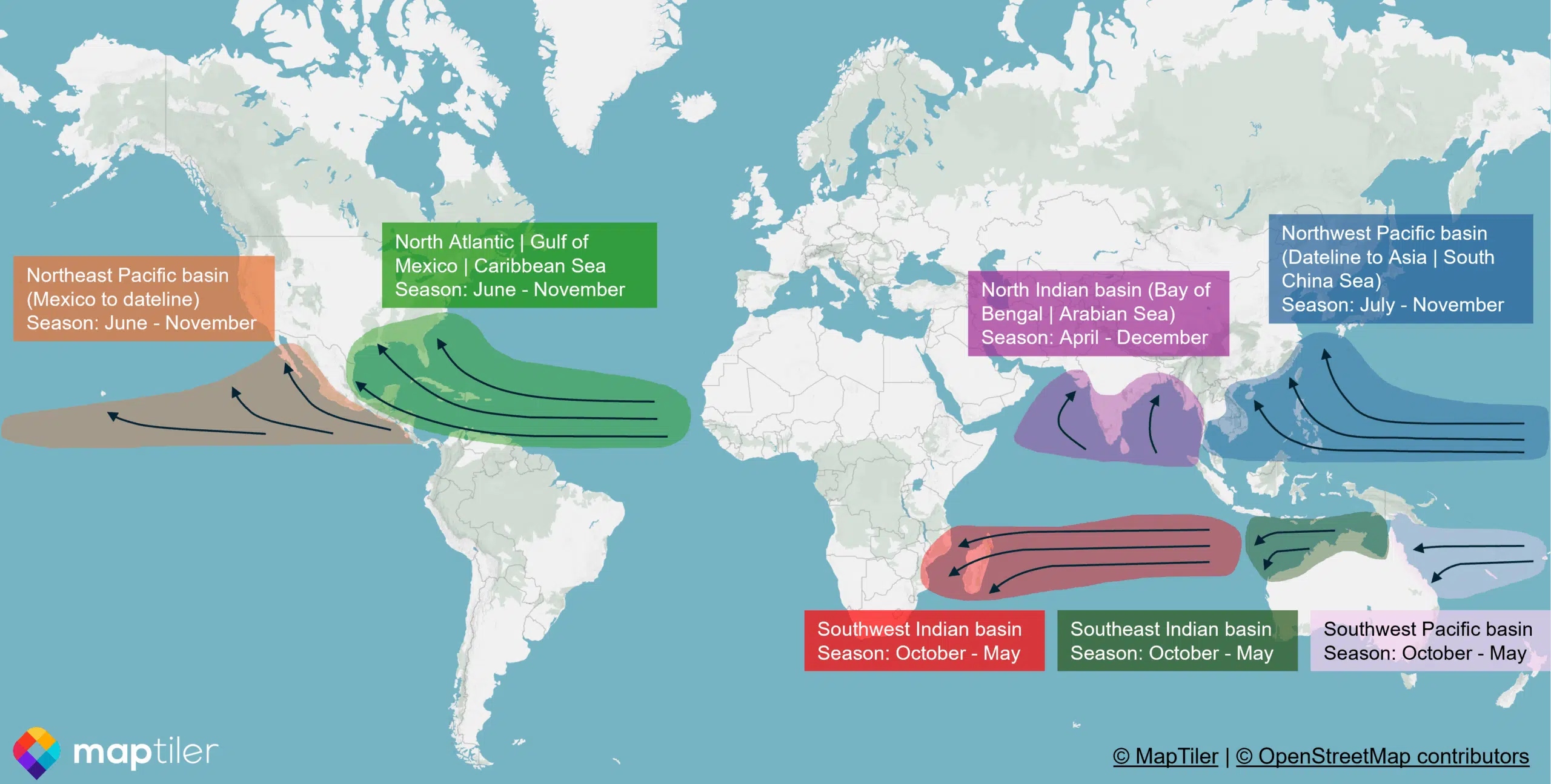
Figure 2: Global cyclone regions and general direction of travel. (Figure adapted from National Oceanic and Atmospheric Administration, 2025).
Tropical weather systems may appear distinct – convection, monsoons, the ITCZ, tropical cyclones – but they are all linked by a shared driver: the transfer of heat and moisture through the atmosphere from the tropics to higher latitudes.
It begins with convection, rising from sun-warmed oceans and forming the foundation of all tropical rainfall. When this convection becomes organised, it evolves into larger systems – clusters of storms, superclusters, and mesoscale convective systems. These are shaped by broader atmospheric dynamics like the Intertropical Convergence Zone, which regulates seasonal rainfall and helps drive powerful monsoons. Under the right conditions, these same forces escalate into tropical cyclones, combining multiple hazards like wind, rain and storm surge into a single, destructive event.
Together, these systems form a connected chain that controls the timing, intensity and type of flooding experienced across the tropics. As the global climate warms, that chain is becoming more volatile, producing heavier rainfall, stronger storms, and more frequent extremes.
Understanding how these systems interact helps us anticipate where and when flooding is likely to occur, and gives governments, organisations and communities the information they need to act early and effectively.
References
IPCC, 2021: Annex V: Monsoons [Cherchi, A., A. Turner (eds.)]. In Climate Change 2021: The Physical Science Basis. Contribution of Working Group I to the Sixth Assessment Report of the Intergovernmental Panel on Climate Change [Masson-Delmotte, V., P. Zhai, A. Pirani, S.L. Connors, C. Péan, S. Berger, N. Caud, Y. Chen, L. Goldfarb, M.I. Gomis, M. Huang, K. Leitzell, E. Lonnoy, J.B.R. Matthews, T.K. Maycock, T. Waterfield, O. Yelekçi, R. Yu, and B. Zhou (eds.)]. Cambridge University Press, Cambridge, United Kingdom and New York, NY, USA, pp. 2193–2204, doi:10.1017/9781009157896.019.
National Oceanic and Atmospheric Administration, 2025: Tropical Cyclone Introduction.
Ready to discuss your next project? Contact our team today.
Discover more about the challenges and solutions shaping resilience and sustainable development across the globe.