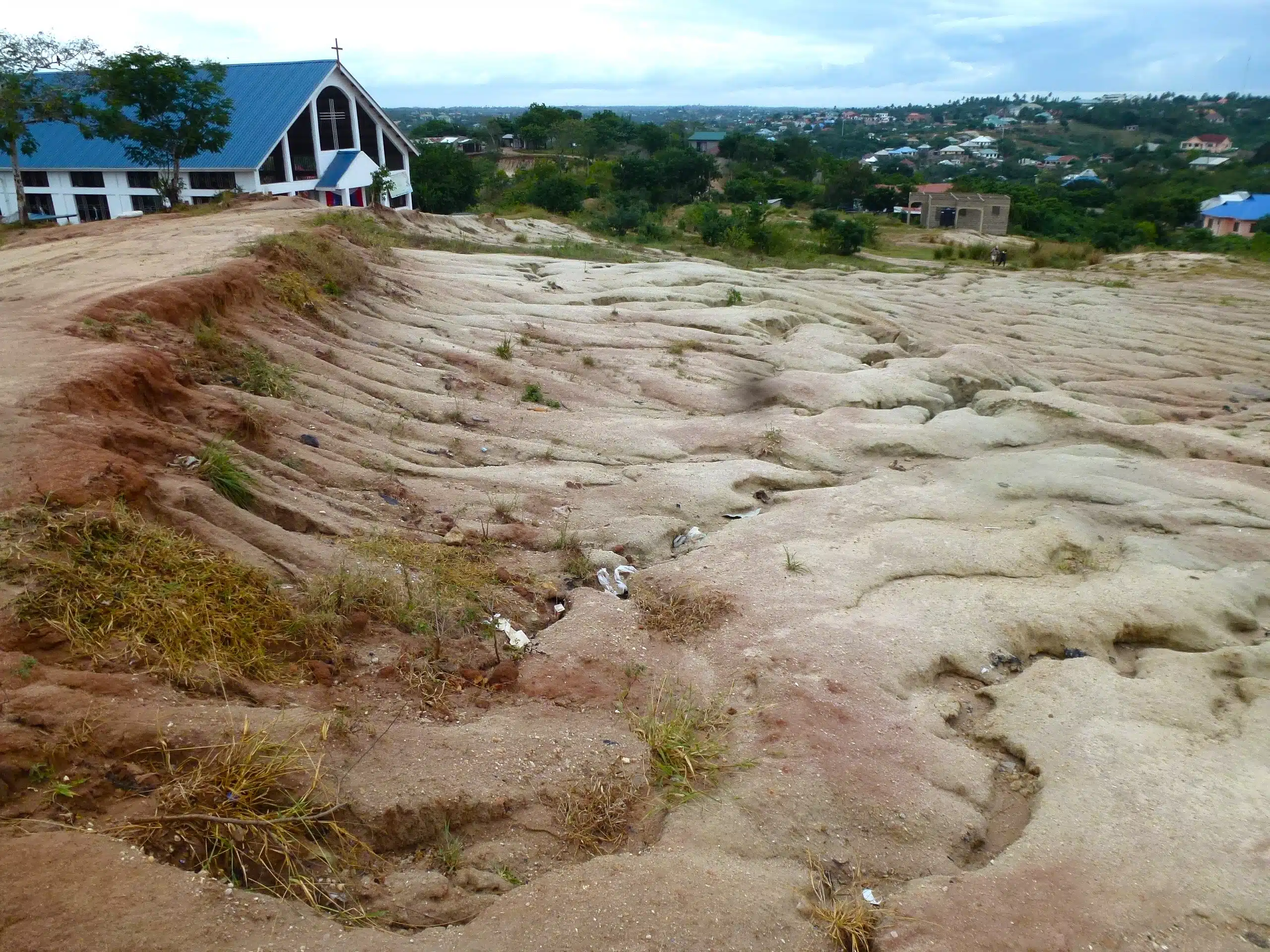
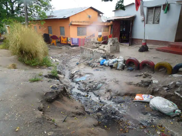
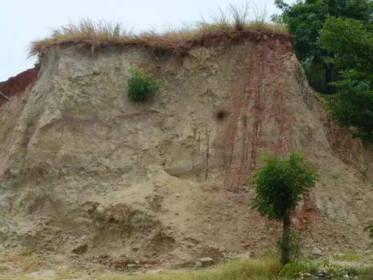
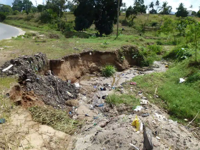
We worked on behalf of the World Bank to assess the impact of sedimentation on flood risk in Dar es Salaam and developed strategies for effective sediment management to strengthen flood resilience.
The Msimbazi River Basin is a vital economic, social and environmental hub. It is home to approximately 1.6 million people and critical infrastructure linking Dar es Salaam’s Central Business District with the rest of the city. However, climate change, rapid urbanisation, land-use changes and deforestation have intensified flooding, exacerbated by increasing sediment accumulation in river systems.
To address these challenges, the Government of Tanzania, with support from the World Bank, launched the Msimbazi Basin Development Project (2022-2028) to strengthen flood resilience and integrate urban development efforts. As part of this initiative, JBA was commissioned to investigate how erosion and sedimentation influence river processes and contribute to flood risk.
We conducted a comprehensive geomorphological assessment to identify sediment sources, transport dynamics and areas most vulnerable to erosion.
Data scarcity in the region required us to adopt innovative data capture approaches, combining collaborative fieldwork with remote sensing techniques. Partnering with the Humanitarian OpenStreetMap Team (HOT) and local universities, we designed and coordinated a field data collection mission. Using digital tools, we systematically recorded and analysed soil samples, creating a city-wide soil profile to support erosion and sediment modelling.
This collaborative approach enabled remote team coordination, rapid deployment of training and technical resources, and systematic data collection. It also established a scalable framework for future projects.
Alongside fieldwork, we applied remote sensing technology to map catchment-scale sediment pathways, analyse large-scale erosion processes and identify high-risk areas. Our findings reinforced the connection between land-use changes and increased sedimentation, highlighting the need for proactive interventions to mitigate these impacts.
To address the challenges identified during the assignment, we provided guidance on integrating sediment monitoring and management into urban and land-use planning. Our recommendations focused on multi-scale interventions, including:
Our recommendations set out long-term strategies to reduce erosion, strengthen flood resilience and support sustainable urban development. These findings provide the foundation for a sustainable delivery plan, embedding sediment management into both policy and practice. By combining geomorphological expertise with remote sensing analysis, we developed a science-based framework that supports decision-makers in taking informed, proactive steps. This work not only addresses immediate sedimentation challenges but also enhances the long-term resilience of Dar es Salaam’s river systems and communities.
Contact our team to learn more about this project.